Earth history · an approximate reconstruction
Before the continents split apart
About 230 million years ago the land that is now separate continents was joined in a single landmass called Pangaea. This illustration shows their approximate arrangement, with modern continent names added so each region can be recognised.
The map
The world before the breakup
Select the map to open it at full size, or download the PNG for teaching, printing or slides.
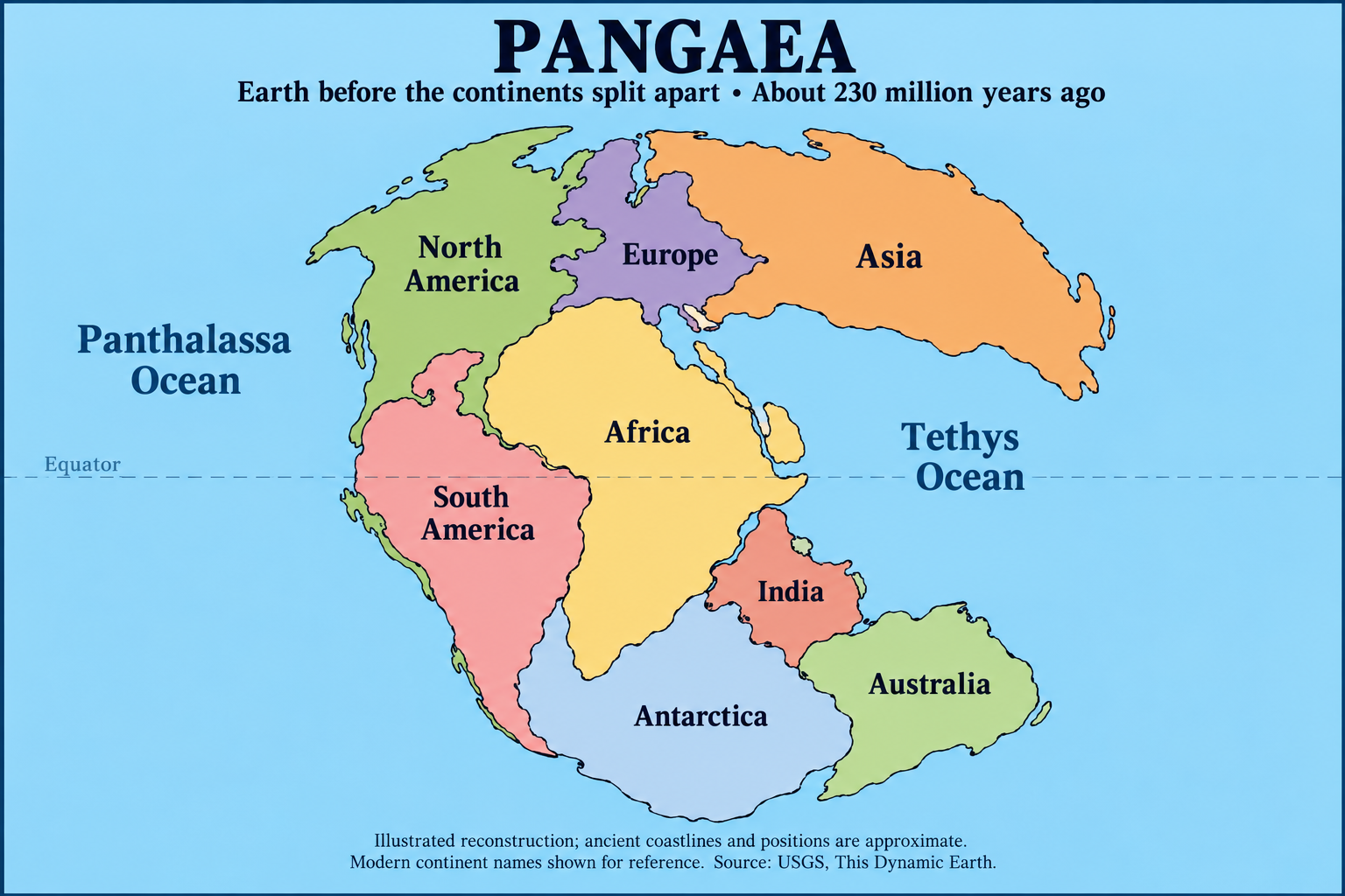
The illustration is a teaching aid, not a survey. It carries no coordinates, no scale and no boundary data, and it is not a substitute for a published geological reconstruction.
What the evidence shows
How we know the continents were once joined
One supercontinent
Land that now forms separate continents was joined together in Pangaea.
A gradual breakup
USGS describes the breakup beginning roughly 225–200 million years ago. Plate motion eventually produced today’s arrangement.
How we know
Matching fossils, rocks and geological structures on separated continents provide evidence of their former connections.
Please note
What this page is, and what it is not
An approximate illustration
The map is a teaching illustration of an approximate arrangement, not a survey. Ancient coastlines and positions are approximate, and the drawing carries no coordinates, scale or boundary data.
Not a USGS product
The illustration was generated for AGAPE FOUNDATION INC. The USGS publications cited below are the research behind the accompanying facts; the USGS did not produce, review or approve this illustration.
Not the Continental Divide
This page is about deep time — the single landmass that existed before the continents separated. The Continental Divide is a different subject: the ridge along the Americas that separates the watersheds draining to the Pacific from those draining to the Atlantic. Pangaea is not the Continental Divide, and nothing here claims otherwise.
Research sources: USGS: Where did dinosaurs live? · USGS: Historical perspective · USGS: Before the breakup of Pangaea